
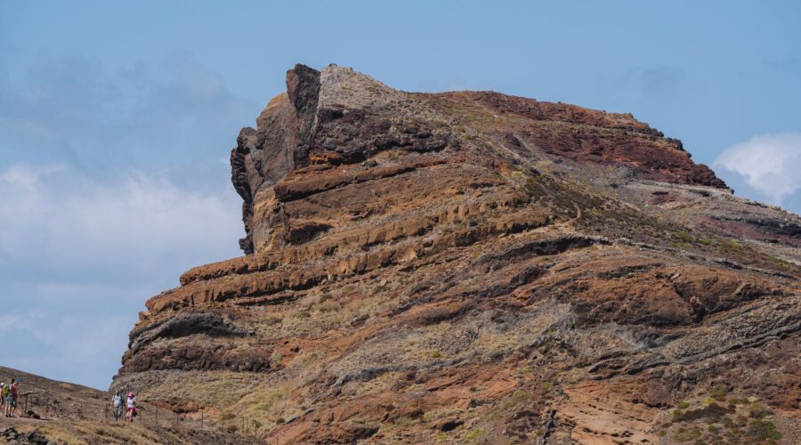
Santo Antão Guide: Hiking & Climbing in Cape Verde’s Peaks
Floating in the middle of the North Atlantic Ocean, approximately 570 kilometers off the coast of West Africa, lies the “Island of Mountains.” Santo Antão is the second-largest island in the Cape Verde archipelago, but for those who seek adventure, it is undoubtedly number one. Unlike the flat, sandy expanses of Sal or Boa Vista, Santo Antão is a dramatic, vertical world of jagged volcanic peaks, verdant terraced valleys, and ancient mule tracks that cling to the edges of mist-shrouded cliffs.
For hikers, climbers, and mountain enthusiasts, Santo Antão is often described as a “hidden Himalaya” in the tropics. Its unique topography—the result of millions of years of volcanic activity and erosion—has created a landscape that is as challenging as it is beautiful. Whether you are looking to scale basalt towers, trek through tropical forests, or scramble across ridge lines with views of the crashing Atlantic, Santo Antão offers an outdoor experience unlike any other on earth.
The Vertical Landscape: A Hiker’s Paradise
Hiking is the primary reason travelers make the ferry journey from the neighboring island of São Vicente to Porto Novo, the gateway to Santo Antão. The island is divided by a massive mountain range that separates the dry, arid south from the lush, humid north. This contrast means that within a few hours of trekking, you can experience two entirely different ecosystems.
The Iconic Cova de Paúl to Vale de Paúl Trek
If there is one hike that defines Santo Antão, it is the descent from the Cova Crater to the Paúl Valley. The journey begins at the rim of an ancient volcanic crater, now filled with meticulously cultivated fields of corn and beans. As you begin the descent into the Paúl Valley, you are greeted by one of the greenest places in Cape Verde. The trail consists of hundreds of stone zig-zags (a masterpiece of traditional engineering) that drop over 1,000 meters toward the ocean.
Along the way, hikers pass through coffee plantations, banana groves, and sugarcane fields. The air is thick with the scent of tropical flowers and the sound of running water from the levadas (irrigation channels). It is an immersive cultural experience where you will share the path with locals carrying goods on their heads and farmers tending to their terraced plots.
The Coastal Challenge: Ponta do Sol to Cruzinha
For those who prefer the meeting of land and sea, the trek from Ponta do Sol to Cruzinha is a world-class coastal route. This 15-kilometer trail is carved directly into the cliffs. It is a dizzying, undulating path that takes you through the abandoned village of Aranhas and the picturesque Fontainhas—a village perched on a narrow ridge that was once ranked by National Geographic as having one of the most beautiful views in the world.
Rock Climbing and Scrambling: Exploring the Basalt Spires
While hiking has long been the island’s main draw, the international climbing community is slowly waking up to the potential of Santo Antão’s volcanic rock. The island is characterized by “dykes”—vertical sheets of rock created by magma cooling in prehistoric fissures. These formations provide exceptional opportunities for traditional climbing and technical scrambling.
The Peaks of Topo de Coroa
The highest point on the island is Topo de Coroa, reaching 1,979 meters (6,493 feet). Located in the rugged, western part of the island, it sits in a desert-like landscape that feels like another planet. Scaling the peak is more of a strenuous hike and scramble than a technical climb, but it requires stamina and navigation skills. From the summit, the 360-degree views of the archipelago are unparalleled, offering a true sense of the island’s isolation and grandeur.
Technical Potential
For serious rock climbers, the areas around Ribeira da Torre and the high ridges above the Paul Valley offer sheer basalt walls. It is important to note that climbing infrastructure (bolted routes, gear shops) is still in its infancy in Cape Verde. Most climbing here is “trad” (traditional), and adventurers should be self-sufficient and experienced. The rock can range from incredibly solid basalt to crumbly volcanic tuff, making route finding an essential skill.
Mountain Climbing and High-Altitude Scenery
The “mountain climbing” on Santo Antão is less about snow and ice and more about the sheer verticality and the “stairmaster” effect of the incredible stone-paved trails. The island’s central spine is a series of interconnected ridges that offer high-altitude traverses.
The trek from Corda to Coculi, for example, takes you along the “spine” of the island. Walking along these narrow ridges with thousands of feet of drop-off on either side is an exhilarating experience that rivals the mountain ridges of Madeira or the Canary Islands. The mist often rolls in from the Atlantic, creating an atmospheric “cloud forest” effect where giant ferns and lichen-covered trees dominate the landscape.
Cultural Immersion: The “Morabeza” of the Mountains
What sets Santo Antão apart from other hiking destinations is the human element. The mountain culture is defined by Morabeza—the Cape Verdean spirit of hospitality. Because many villages in the interior are still only accessible by foot, the trails are not just for tourists; they are the lifelines of the community.
During a day of climbing or hiking, you might be invited into a stone house for a cup of locally grown coffee or a glass of grogue (the island’s potent sugarcane rum). The sight of a donkey train carrying supplies up a steep mountain pass is a reminder of a way of life that has remained unchanged for decades.
Practical Tips for Your Adventure
When to Go
The best time for hiking and climbing in Santo Antão is from October to June. During these months, the weather is generally dry and the temperatures are comfortable for physical exertion. The “rainy” season (August and September) can make trails slippery and prone to landslides, though it does result in a spectacularly green landscape.
Getting There
There is no functioning airport on Santo Antão. To get there, you must fly into Cesária Évora Airport (VXE) on the island of São Vicente and then take a 60-minute ferry from Mindelo to Porto Novo. The ferry ride is an adventure in itself, often offering sightings of flying fish or even whales during the winter months.
Gear and Preparation
- Footwear: High-quality trekking boots with good ankle support are non-negotiable. The volcanic rock is sharp and the stone paths can be unforgiving on the joints.
- Navigation: While many trails are marked, they can be confusing. Using an app like AllTrails or Komoot is helpful, but hiring a local guide is highly recommended—both for safety and to support the local economy.
- Hydration: The sun is intense. Always carry more water than you think you need, and use electrolyte tabs.
Conclusion: An Unforgettable Vertical Frontier
Santo Antão is not a destination for the casual tourist seeking an easy beach holiday. It is an island that demands effort, sweat, and a bit of vertigo. But for those who are willing to climb its peaks and traverse its valleys, the reward is a sense of discovery that is increasingly hard to find in the modern world. It is a place where the majestic power of nature is on full display, and every turn of the trail reveals a new, breathtaking vista. If you are a lover of the mountains, Santo Antão is calling.
Image: Pexels – Diogo Miranda