Barlavento and Sotavento: Cape Verde’s Island Groups
Floating in the central Atlantic Ocean, approximately 570 kilometers off the coast of West Africa, lies the Republic of Cabo Verde. This ten-island archipelago is defined by more than just its volcanic origins and turquoise waters; it is characterized by a fundamental geographical and cultural split. The islands are organized into two distinct groups based on the prevailing trade winds: the Barlavento (Windward) and the Sotavento (Leeward).
For travelers and scholars alike, understanding the divide between these two groups is essential to grasping the “Morabeza”—the unique spirit of hospitality—that defines the nation. From the flat, sandy deserts of Sal to the rugged, towering peaks of Fogo, the distinction between the Barlavento and Sotavento groups shapes everything from the local climate to the economic landscape.
The Barlavento Islands: The Northern Windwards
The Barlavento group comprises the northern arc of the archipelago. Translated literally as “Windward,” these islands are the first to encounter the northeasterly trade winds that sweep across the Atlantic. The group includes Santo Antão, São Vicente, Santa Luzia (uninhabited), São Nicolau, Sal, and Boa Vista.
Geographical Diversity: From Sand to Stone
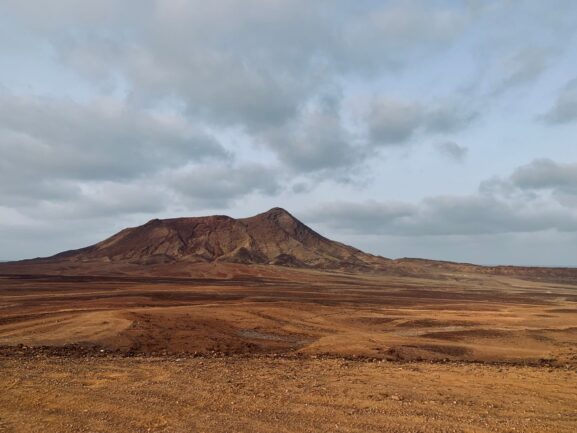
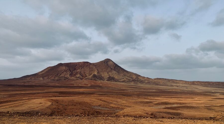
The Barlavento islands offer a striking study in contrasts. To the east, Sal and Boa Vista are relatively old in geological terms. These islands are flat, arid, and characterized by vast white-sand beaches and extensive salt flats. Because of their terrain and proximity to the African mainland, they are often subject to the Harmattan—a dry, dusty wind from the Sahara. These islands have become the hub of Cape Verde’s growing tourism sector, attracting sun-seekers from around the globe.
Conversely, the western Barlavento islands like Santo Antão and São Vicente are spectacularly mountainous. Santo Antão, the second largest island in the country, is a hiker’s paradise, featuring deep ravines and peaks that catch ocean mist, allowing for lush vegetation and “laurel forests” that defy the country’s stereotypically arid reputation. São Vicente is home to Mindelo, the undisputed cultural capital of the archipelago. Its deep-water harbor made it a crucial mid-Atlantic shipping stop during the 19th century, a legacy that lives on through its cosmopolitan atmosphere and vibrant music scene.
The Sotavento Islands: The Southern Leewards
Positioned to the south, the Sotavento or “Leeward” islands are tucked away from the direct blast of the northern trade winds. This group consists of Maio, Santiago, Fogo, and Brava. The Sotavento group is the administrative heart of the nation and home to the majority of its population.
Santiago: The Powerhouse of the South
Santiago is the largest, most populous, and most diverse island in the archipelago. It hosts the nation’s capital, Praia, and was the site of the first European settlement in the tropics, Cidade Velha (formerly Ribeira Grande). Geographically, Santiago acts as a microcosm of the entire country, featuring jagged mountain ranges, fertile valleys used for banana and sugarcane cultivation, and bustling urban centers.
Fogo and Brava: Fire and Flowers
To the west of Santiago lies the dramatic island of Fogo. It is dominated by Pico do Fogo, an active volcano that reaches 2,829 meters above sea level. Fogo represents the “younger” side of the archipelago’s volcanic history, with its most recent eruption occurring in 2014. The volcanic soil provides a unique terroir for “Chã das Caldeiras” wine and high-quality coffee.
Further west is Brava, the smallest inhabited island. Known as the “Island of Flowers,” its high elevation and humid climate make it a garden-like retreat. Historically, Brava has a deep connection with the United States; during the 19th century, American whaling ships frequently stopped here, leading to a significant Cape Verdean diaspora in New England.
The Climate Gap: Aridity vs. Orographics
The geographical divide directly impacts the life-sustaining moisture available to each group. Cape Verde sits within the Sahelian semi-arid belt, making water a precious resource. However, the high mountains of the western Barlavento (Santo Antão) and the central Sotavento (Santiago and Fogo) create orographic precipitation. As humid air is forced upward by the steep terrain, it condenses into mist and rain.
This creates “micro-climates” where lush woods and agriculture can thrive, contrasting sharply with the desert-like conditions found on the flat islands of Sal and Maio, where annual rainfall often drops below 100 millimeters. This climate disparity has historically dictated where people could farm and where they had to rely on the sea or trade.
Political and Economic Evolution
While the islands were uninhabited until the 15th century, their strategic position quickly made them a linchpin of the transatlantic slave trade. This dark history was centered largely in the Sotavento, specifically at Cidade Velha on Santiago. As the slave trade declined in the 19th century, the economic center of gravity shifted north to the Barlavento, particularly to Mindelo’s harbor in São Vicente, which became a vital coal depot for steamers crossing the Atlantic.
Since gaining independence in 1975, Cape Verde has evolved into one of Africa’s most stable and democratic nations. Today, the “divide” is more of a collaboration: the Sotavento (Praia) remains the political and administrative hub, while the Barlavento (Sal and Boa Vista) serves as the economic engine for tourism, and São Vicente remains the cultural gateway.
Environmental Challenges: A Shared Future
Despite their differences, both the Barlavento and Sotavento groups face the existential threat of climate change. As an archipelagic nation, Cape Verde is highly vulnerable to rising sea levels and shifting hurricane patterns. Interestingly, many Western Hemisphere hurricanes begin as “Cape Verde-type” storms, forming near the islands before gaining intensity over the Atlantic.
In response, the nation has become a global leader in sustainability. As of 2023, 20% of its energy is renewable, with a goal of 50% by 2030. Whether on the wind-swept plains of Boa Vista or the volcanic slopes of Fogo, the Cape Verdean people are united in their effort to preserve their unique corner of the Macaronesia ecoregion.
Conclusion
The Barlavento and Sotavento islands represent two sides of the same resilient coin. One group looks toward the wind and the horizon of global tourism, while the other holds the deep roots of the nation’s history and political identity. Together, they form a country that—despite its lack of natural resources—has used its geography to become a beacon of stability and development in the central Atlantic.
Image: Pexels – Bibi Kiekens