The Cape Verde Rise: The Secrets of the Archipelago’s Geology
Beneath the azure waters of the central Atlantic Ocean lies a geological phenomenon so vast it alters the very shape of the Earth’s gravitational field. Known to scientists as the Cape Verde Rise (or the Cabo Verde Swell), this massive bathymetric feature is the foundation upon which the ten volcanic islands of the archipelago rest. While the islands themselves are world-renowned for their vibrant Creole culture and “morabeza” hospitality, the secret to their existence is buried deep beneath the seafloor.
What is the Cape Verde Rise?
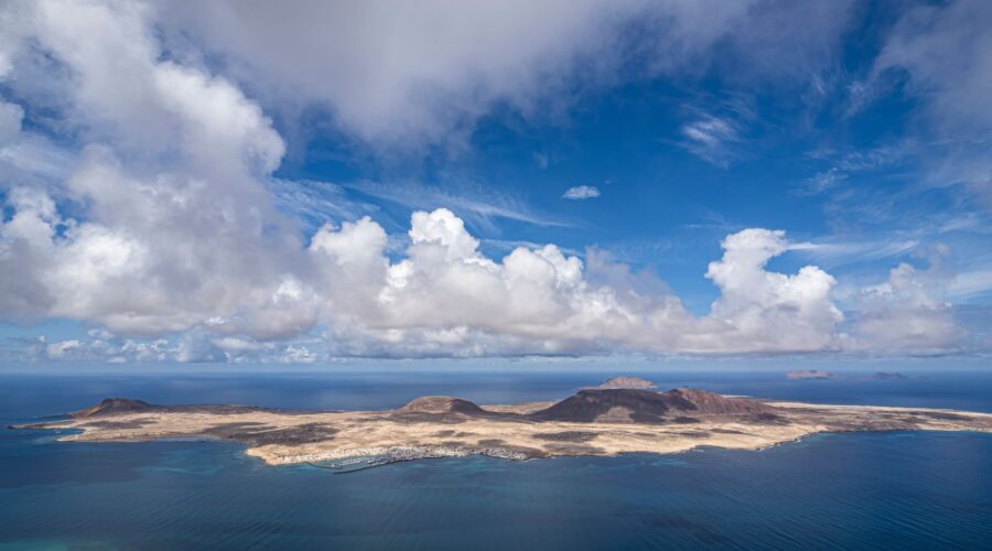
The Cape Verde Rise is one of the largest “bathymetric swells” in the world’s oceans. In geological terms, a swell is a broad, elevated region of the seafloor that rises significantly higher than the surrounding abyssal plains. The Cape Verde Rise is a staggering feature: it elevates the ocean floor by approximately 2.2 kilometres (1.4 miles) above the surrounding deep-sea bed.
Covering a semi-circular area of roughly 1,200 square kilometres (460 sq mi), the Rise is so massive that it is associated with a noticeable “rise of the geoid”—a bulge in the Earth’s mathematical shape caused by the concentration of mass in this specific region. This suggests that the force pushing the archipelago upward isn’t just a local volcanic vent, but a massive thermal or mantle-driven engine operating deep within the Earth’s interior.
The Origins: A Story 150 Million Years in the Making
To understand the Cape Verde Rise, one must look back to the Jurassic and Cretaceous periods. Magnetic anomalies identified near the archipelago suggest that the underlying crustal structures began forming between 125 and 150 million years ago. However, the islands as we see them today are much younger.
The eastern islands, such as Maio and Sal, are the “elders” of the group, with exposed rocks dating back roughly 20 million years. In contrast, the western islands like Santo Antão and Brava are geological youngsters, appearing only about 8 million years ago. This age progression is a classic hallmark of a hotspot—a stationary plume of hot mantle material. As the African tectonic plate slowly drifted over this hotspot, the plume “punched” through the crust at different intervals, creating the horseshoe-shaped chain we see today.
Pillow Lavas and Ancient Secrets
Interestingly, some of the oldest rocks in the entire Atlantic can be found on the island of Maio and the northern peninsula of Santiago. These are 128 to 131 million-year-old “pillow lavas”—rounded structures formed when molten rock erupts directly into cold seawater. These ancient formations provide a rare window into the early history of the Atlantic Ocean’s opening.
Geological Composition: The “Soda-Alkaline” Province
The islands are primarily composed of igneous rocks, consisting of volcanic structures and pyroclastic debris. Geologists categorize Cape Verde as a soda-alkaline petrographic province. This means the lavas are rich in sodium and potassium, a chemical signature similar to other Macaronesian archipelagos like the Canary Islands and the Azores.
While most of the islands have seen their volcanic activity go dormant, the island of Fogo remains a powerful reminder of the forces at work. The Pico do Fogo, rising to 2,829 metres (9,281 feet) above sea level, is the most active volcano in the region. Its most recent eruption in 2014 showcased the raw power of the Cape Verde Rise, as lava flows emerged from an eight-kilometre-wide caldera formed by ancient volcanic subsidence.
How the Rise Influences the Climate
The massive elevation of the Cape Verde Rise doesn’t just affect the seafloor; it dictates the life and survival of the people on the islands. Because these volcanic peaks rise so abruptly from the ocean, they interact with the Atlantic trade winds in a phenomenon known as orographic lift.
While the flat, sandy islands of Sal and Boa Vista remain arid and desert-like (receiving less than 150 mm of rain annually), the towering mountains of Santiago, Santo Antão, and São Nicolau catch humid ocean air. As the air is forced up the slopes of these mountains, it condenses into mist and rain. This allows for “monsoon forests” and lush vegetation to thrive in high-altitude pockets, contrasting sharply with the dry, lunar landscapes found at sea level.
The Birthplace of Hurricanes
The Cape Verde Rise also plays a role in global weather patterns. The archipelago is the namesake for “Cape Verde-type hurricanes.” These storms form as tropical waves move off the African coast and gain strength over the warm waters surrounding the islands. Because they have the entire width of the Atlantic to develop, Cape Verde hurricanes are often the largest and most intense storms of the season, including legendary cyclones like Hurricane Ivan and Hurricane Katrina.
A Heritage Defined by Earth and Sea
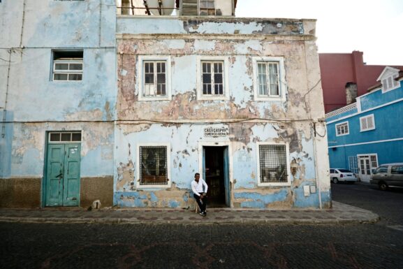
The history of the Cape Verdean people is inextricably linked to this geological foundation. Discovered by Portuguese and Genoese navigators in 1456, the islands were uninhabited until the 15th century. The strategic position afforded by the Rise made the islands a crucial hub for the transatlantic slave trade and, later, a vital stop for transatlantic shipping and telegraph cables.
Today, the Republic of Cabo Verde is a model of stability and democracy in Africa. Despite a lack of natural resources on land, the nation is looking to its geological and geographical situation to build a sustainable future. The government has become a leader in renewable energy, aiming to provide 50% of its energy from wind and solar sources by 2030.
Key Facts About the Cape Verde Rise
- Swell Height: 2.2 kilometres above the ocean floor.
- Oldest Rocks: 131 million-year-old pillow lavas on Maio.
- Last Eruption: 2014 on the island of Fogo.
- Geological Ecoregion: Part of Macaronesia (alongside the Azores, Canaries, and Madeira).
Conclusion
The Cape Verde Rise is more than just a footnote in a geology textbook; it is the silent architect of an entire nation. From the treacherous cliffs of Santo Antão to the fertile slopes of Fogo, the archipelago owes its existence to the massive bathymetric swell that pushed these islands toward the sun. For the traveler or the scientist, understanding the Rise offers a deeper appreciation for this “Green Cape”—a resilient island nation standing tall in the middle of the vast Atlantic.
Image: Pexels – Marian Florinel Condruz