The Ocean Cliffs of Cape Verde: Volcanic Debris Landslides
Rising dramatically from the turquoise depths of the central Atlantic, the archipelago of Cape Verde (Cabo Verde) offers a landscape that is as beautiful as it is violent. While many travelers are drawn to the sun-drenched sands of Sal or the rhythmic soul of Mindelo, geologists and nature enthusiasts find their wonder in the archipelago’s verticality. The towering ocean cliffs of islands like Santo Antão, Santiago, and São Nicolau are more than just scenic backdrops; they are the silent, staggering witnesses to some of the most catastrophic geological events in Earth’s history: massive debris landslides.
A Volcanic Legacy 50 Million Years in the Making
To understand the cliffs, one must understand the origin of the islands. Located approximately 570 kilometers (350 miles) off the coast of West Africa, Cape Verde is a volcanic archipelago formed during the Eocene epoch, roughly 40 to 50 million years ago. These islands sit upon the Cape Verde Rise, a massive bathymetric swell that is one of the largest protuberances in the world’s oceans.
The islands were built by successive layers of basic igneous rocks and pyroclastic debris. As these volcanoes grew from the seafloor, reaching heights of thousands of meters, they became inherently unstable. The combination of rapid vertical growth, the weight of new lava flows, and the underlying structural weaknesses of volcanic pedestals created a “ticking time bomb” of gravitational instability.
The Physics of Catastrophe: Debris Landslides
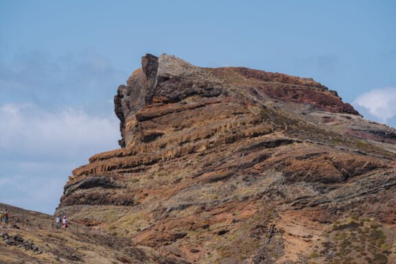
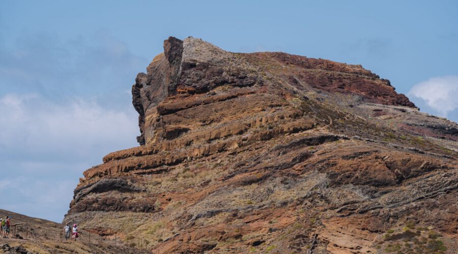
The sheer ocean cliffs that define much of the Cape Verdean coastline—particularly on the “windward” Barlavento islands—are not merely the result of gradual erosion by waves. Instead, many were formed in geological heartbeats through catastrophic debris landslides.
In these events, an entire flank of a volcano collapses, sending cubic kilometers of rock, earth, and volcanic debris thundering into the ocean. These are among the most energetic events on the planet. When a mountain literally falls into the sea, it leaves behind a “scar”—a near-vertical cliff face that can drop hundreds of meters directly into the Atlantic. These landslides were likely powerful enough to trigger mega-tsunamis, with waves reaching heights that defy the imagination, crashing into neighboring islands and even distant continents.
The Fogo Collapse: A Prime Example
Nowhere is this geological drama more evident than on the island of Fogo. While Fogo remains home to the largest active volcano in the region (Pico do Fogo, which last erupted in 2014), its most striking feature is its massive eight-kilometer-diameter caldera. Scientists believe that a significant portion of the island’s eastern flank collapsed into the sea thousands of years ago, a classic example of the debris landslides that have shaped the archipelago’s jagged profile.
The Resulting Landscape: Vertigo and Vitality
The aftermath of these ancient collapses has created a unique topography that dictates the lives of the 530,000 people who call Cape Verde home. On islands like Santo Antão and Santiago, these landslides have left behind “towering mountains” where arid slopes suddenly give way to vertical drops.
However, the cliffs do more than just provide a view. Because of the relief created by these steep mountains, the islands experience orographically induced precipitation. As humid Atlantic air hits the high cliff walls, it is forced upward, condensing into mist and rain. This allows for:
- Lush Microclimates: In the shadows of these giants, one can find “dry monsoon forests” and “laurel forests” that contrast sharply with the desert landscapes of the flat islands like Sal.
- Vertical Agriculture: Local farmers have adapted to this steep terrain, planting sugarcane fields and banana plantations along the bases and terraced slopes of the mountain-cliff systems.
- Endemic Biodiversity: The isolation provided by these high-altitude, cliff-bound regions has led to the evolution of several endemic species, such as Alexander’s swift and the Cape Verde warbler, which find sanctuary in the inaccessible crags.
Practical Information for Visiting the Cliffs
For those looking to witness the results of these prehistoric landslides firsthand, Cape Verde offers unparalleled hiking and sightseeing opportunities. Here are the top locations to experience the verticality of the islands:
1. Santo Antão: The Hiker’s Paradise
Santo Antão is widely considered the most spectacular island for cliff-watching. The coastal road between Ponta do Sol and Cruzinha is carved into the side of massive ocean cliffs, offering dizzying views of the Atlantic. The interior “Ribeiras” (deep valleys) are the result of both erosion and ancient collapses, creating a landscape that feels like a tropical version of the Alps.
2. Santiago: The Heart of the Archipelago
As the largest and most populous island, Santiago hosts the capital, Praia. However, the island’s interior and northern coastlines feature the “oldest exposed rocks” in the country—128-million-year-old pillow lavas. The cliffs here provide a rugged backdrop to a culture rich in history, from the ruins of Cidade Velha (the first European settlement in the tropics) to the bustling markets of Assomada.
3. Fogo: Walking on the Edge
A trip to Chã das Caldeiras on Fogo allows you to stand within the footprint of a giant volcanic collapse. The sheer walls of the “Bordeira” (the caldera rim) rise 1,000 meters above the valley floor, showing the internal layers of the volcano exposed by the subsidence of the magma chamber and subsequent landslides.
The Future: Climate Change and Geological Stability
While the catastrophic landslides that formed the cliffs occurred thousands or millions of years ago, the islands remain at the “frontlines of the existential crisis” of climate change. UN Secretary-General António Guterres and world leaders have highlighted Cape Verde’s vulnerability to rising sea levels and extreme weather.
As the sea warms, the frequency of “Cape Verde-type hurricanes”—the most intense storms in the Atlantic—may increase. While the cliffs themselves are solid rock, the human settlements at their feet are increasingly vulnerable to the rising tides. In response, Cape Verde has become a leader in renewable energy in sub-Saharan Africa, aiming for 50% renewable energy by 2030, and engaging in innovative “debt-for-nature” swaps to protect its unique environment.
Conclusion
The ocean cliffs of Cape Verde are more than just a beautiful sight; they are a profound record of Earth’s power. They tell a story of islands that rose from the sea, collapsed under their own weight, and eventually became a stable, democratic “success story” in the middle of the Atlantic. Whether you are standing on the rim of Fogo’s caldera or hiking the verdant trails of Santo Antão, you are witnessing the magnificent, jagged results of a planet that is constantly reshaping itself.
Image: Pexels – Diogo Miranda