
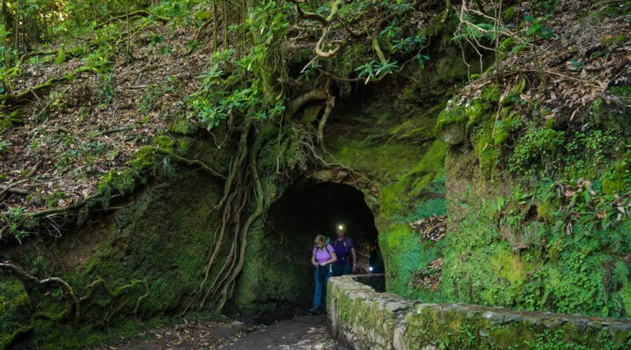
Caminho das Águas: Santo Antão’s Ancient Stone Aqueducts
In the rugged, cloud-crowned northern reaches of Santo Antão, the second-largest island in the Cape Verde archipelago, lies a feat of engineering so improbable it seems to defy gravity. Here, in the deep, emerald-green valleys of Ribeira Grande, a network of stone arteries clings to the basalt cliffs. Known as the Caminho das Águas (the Path of the Waters), these ancient levadas and hanging aqueducts are the lifeblood of the island’s legendary “hanging gardens.”
For travelers and hikers, the Caminho das Águas is more than just a trail; it is a journey into the soul of Cape Verdean resilience. It is a story of how man, faced with vertical landscapes and a semi-arid climate, sculpted a lush paradise out of volcanic rock using nothing but stone, lime, and an intimate understanding of gravity.
The Vertical Oasis: Understanding the Geography of Ribeira Grande
Santo Antão is an island of dramatic contrasts. While the south is arid and lunar, the north is a vertical rainforest. The Ribeira Grande valley—the largest and deepest on the island—is characterized by sheer cliffs that rise hundreds of meters from the valley floor. Because the valley floor is narrow, the islanders had nowhere to go but up.
To survive, the inhabitants of Santo Antão developed a system of socalcos (terraced fields). These terraces wrap around the mountains like the steps of a giant’s staircase. However, terraces are useless without water. The challenge was transporting water from high-altitude springs (nascentes) across gaping ravines and along vertical cliff faces to reach the thirsty crops of sugarcane, coffee, and yams below. The solution was the levadas and their spectacular stone aqueducts.
Engineering the Impossible: The Stone Aqueducts
The Caminho das Águas refers to the historical infrastructure built to manage this irrigation. The most striking features of this system are the stone aqueducts. Unlike the Roman arches of Europe, these structures are often built into the very skin of the mountain. In places where the cliff face is too steep for a channel, the islanders constructed narrow stone bridges that leap across abysses, carrying a small stream of water in a hand-carved groove.
Constructed primarily in the 19th and early 20th centuries, these channels were built using local basalt and a mortar made from lime. The precision required was immense; the gradient had to be steep enough to keep the water moving but gentle enough to prevent erosion and overflow. Walking alongside these channels today, one can see the tool marks left by generations of pedreiros (stonemasons) who worked while suspended by ropes over hundreds of feet of empty space.
The ‘Levadeiros’: Guardians of the Current
The engineering is only half the story. The management of the Caminho das Águas is a social masterpiece. To this day, the water is distributed according to an ancient system of giros (turns). Each farmer is entitled to a specific number of hours of water flow. This system is overseen by the levadeiros, men who walk these vertiginous paths daily to clear debris, patch leaks, and open the sluice gates that redirect the flow from one terrace to the next.
Hiking the Path: A Vertiginous Adventure
For the modern explorer, following the Caminho das Águas offers one of the most visually stunning trekking experiences in the Atlantic. The trails often follow the narrow stone walls of the levadas themselves. At times, the path is barely two feet wide, with a mossy wall on one side and a sheer drop into the valley on the other.
From Cova de Paúl to Ribeira Grande
One of the most popular routes to experience this hydraulic heritage begins at the Cova de Paúl, a massive volcanic crater now used for agriculture. As you descend toward the Ribeira Grande valley, the air grows humid and the vegetation shifts from pine and eucalyptus to giant ferns and banana groves. As the valley narrows, the stone aqueducts begin to appear, winding around the “ribs” of the mountain.
The Hanging Gardens of Fontainhas
Near the end of the Ribeira Grande system lies Fontainhas, a village famously described by National Geographic as having one of the most beautiful views in the world. Here, the hanging gardens are at their most dramatic. The village clings to a narrow ridge, surrounded by circular terraces that look like green amphitheatres. The water that sustains this beauty arrives via a network of stone channels that seem to hang suspended in the mist.
Cultural Significance: Grogue and the Economy of Water
The water carried by the Caminho das Águas doesn’t just grow food; it fuels the island’s primary industry: Grogue. This potent Cape Verdean rum is distilled from sugarcane grown on the terraced slopes. The water wheels (trapiches) used to crush the cane were historically powered by the very water flowing through these aqueducts.
The sound of rushing water is the constant soundtrack of life in Ribeira Grande. It is a symbol of wealth and survival. In the local Kriolu language, to have “water in the levada” is a metaphor for prosperity and the flow of life itself.
Practical Information for Travelers
If you are planning to explore the Caminho das Águas, keep the following in mind:
- Best Time to Visit: The period between November and March offers the best hiking weather—cool temperatures and lush greenery following the autumn rains.
- Physical Requirements: This is not a trek for those with severe vertigo. The paths are safe but narrow and very high. Good hiking boots with excellent grip are essential, as the stones can be slippery with moss and water.
- Guides: While many paths are marked, hiring a local guide is highly recommended. Not only will they keep you on the right track, but they can also explain the complex “giro” water system and identify the medicinal plants growing along the stone walls.
- Access: Most treks into the Ribeira Grande system start from the mountain pass of Corda or the town of Ponta do Sol. You can reach Santo Antão via a 1-hour ferry from Mindelo, São Vicente.
The Future of the Path
Today, the Caminho das Águas faces challenges. Modern plastic piping is increasingly used to replace the ancient stone channels because it is cheaper and easier to maintain. However, there is a growing movement to preserve these stone aqueducts as a UNESCO-worthy cultural heritage site. They are not merely pipes; they are a monument to the Cape Verdean spirit—an enduring testament to a people who refused to be limited by the verticality of their world.
To walk the Path of the Waters is to witness a silent dialogue between man and mountain. It is a place where every drop of water tells a story of labor, every stone represents an ancestor’s grip, and the resulting gardens stand as a verdant victory over the void.
Image: Pexels – Hikerwise