The 2014 Pico do Fogo Eruption: Impact and Recovery
In the heart of the Atlantic Ocean, the island of Fogo stands as a testament to the raw power of nature. Known for its perfectly conical silhouette, Fogo (the Portuguese word for “fire”) is home to the most active volcano in the Cape Verde archipelago. While the island has a long history of seismic activity, the eruption that began on November 23, 2014, remains etched in the memory of the Cabo Verdean people as one of the most transformative natural disasters in the nation’s history.
The Awakening: November 23, 2014
For nearly 20 years, the residents of Chã das Caldeiras—a unique community living inside the volcano’s massive eight-kilometer-wide caldera—had enjoyed a period of relative peace. The last major eruption had occurred in 1995, and life in the shadow of the peak had returned to its rhythmic normalcy of viticulture and tourism. However, in the early morning hours of November 23, the earth began to rumble with renewed intensity.
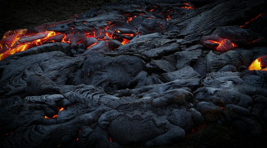
Unlike many explosive volcanic events, the 2014 eruption of Pico do Fogo was characterized by Hawaiian-style fissures and slow-moving but relentless lava flows. Rising from an interior cone that reaches 2,829 meters above sea level, the lava didn’t just flow; it consumed. For 77 days, the world watched as the molten rock advanced toward the villages of Portela and Bangaeira.
Impact on Chã das Caldeiras
The human and economic toll of the 2014 eruption was devastating, though miraculously, no lives were lost. This was largely due to the efficiency of the evacuation efforts and the slow speed of the lava, which allowed residents to salvage some belongings before their homes were overtaken. However, the physical destruction was absolute:
- Displacement: Approximately 1,200 residents were forced to flee, leaving behind their ancestral lands and livelihoods.
- Structural Loss: Over 90% of the buildings in Portela and Bangaeira were destroyed. This included the community’s primary school, the local church, and most of the infrastructure dedicated to the island’s burgeoning tourism industry.
- Agricultural Ruin: The lava flows buried vast tracts of fertile volcanic soil. The Chã das Caldeiras region is famous for its “Manecom” wine and fruit orchards; the eruption destroyed many of the vineyards and the head office of the local wine cooperative.
By the time the eruption officially ended in February 2015, the landscape of the caldera had been fundamentally altered. What once were thriving streets were now buried under layers of black, jagged basalt.
The Resilience of the Fogo People
The recovery of Chã das Caldeiras is a story of profound “morabeza” (the Cape Verdean spirit of hospitality and resilience). Despite government efforts to resettle the displaced population in safer areas lower down the mountain, many residents felt an unbreakable bond with the caldera. Within months of the eruption’s end, villagers began to return, braving the heat still radiating from the ground to rebuild.
The recovery process has been a blend of grassroots determination and international aid. Modern houses, designed to be more resilient and portable, have been constructed. The wine cooperative, vital to the local economy, was eventually rebuilt, continuing the tradition of producing wine from grapes grown in the mineral-rich volcanic ash.
Tourism as a Catalyst for Recovery
In a fascinating turn of events, the very disaster that destroyed the community has become a draw for international visitors. Today, Pico do Fogo is one of Cape Verde’s premier hiking destinations. Tourists flock to the island to witness the “lunar landscape” created by the 2014 flow. Local guides, many of whom lost their homes in the eruption, now lead trekkers up the main cone and through the new lava fields, narrating their personal stories of survival and rebuilding.
Geological Context and Future Monitoring
Cape Verde is a volcanic archipelago formed 40–50 million years ago, situated on the Cape Verde Rise. While Fogo is the only island with historical activity within the era of human settlement, the 2014 event served as a wake-up call for the region. The eruption was a result of subsidence and the movement of magma from a chamber approximately eight kilometers deep.
Since the 2014 event, monitoring systems on Fogo have been modernized. International volcanologists work closely with Cape Verdean authorities to track seismic tremors and gas emissions, ensuring that the people of Chã das Caldeiras have as much warning as possible should the “fire” decide to wake up again.
Conclusion: Living with a Giant
The 2014 eruption of Pico do Fogo remains a pivotal moment in the history of Cabo Verde. It highlighted the vulnerability of island nations to geological forces but also showcased the incredible fortitude of the Cape Verdean people. Today, Chã das Caldeiras is a place where life blooms amidst the lava—a testament to a community that refuses to be defined by disaster, but rather by their enduring relationship with the magnificent, unpredictable mountain they call home.
Image: Pexels – David Zherdenovsky