Cape Verde Climate Guide: The Sahelian Semi-Arid Belt
Strategically positioned in the eastern Atlantic Ocean, the archipelago of Cape Verde (officially Cabo Verde) serves as a dramatic gateway between the African continent and the Americas. While its stunning volcanic landscapes and vibrant Creole culture draw thousands of tourists annually, the nation is defined by a complex meteorological reality: it sits at the westernmost edge of the Sahelian semi-arid belt.
Understanding Cape Verde’s climate requires looking beyond its “Green Cape” name—an irony bestowed by 15th-century Portuguese explorers who named the islands after the lush Cap-Vert peninsula in Senegal. In reality, the archipelago is a study in aridity, resilience, and the delicate balance of the Macaronesian ecoregion.
The Sahelian Connection: A Geographic Outpost
Cape Verde consists of ten volcanic islands located between 600 and 850 kilometers west of Dakar. Despite being surrounded by the vast Atlantic Ocean, the islands share the climatic DNA of the Sahel, the transition zone in Africa between the Sahara Desert to the north and the Sudanian savanna to the south. This positioning subjects the islands to a “dry monsoon” climate, characterized by long periods of drought and a very short, unpredictable rainy season.
The archipelago’s climate is milder than the African mainland because the surrounding sea moderates extreme heat. However, the cold Atlantic currents produce an arid atmosphere. Unlike the West African coast, the islands do not benefit from significant moisture-laden upwelling, resulting in an environment where water is the most precious resource.
Rainfall Patterns: A Tale of Two Landscapes
Rainfall in Cape Verde is notoriously irregular, typically occurring only between August and October. When it does arrive, it often takes the form of brief, heavy downpours that can cause flash flooding due to the steep, rocky terrain. The archipelago is divided into four ecological zones based on altitude and precipitation:
1. The Arid Lowlands
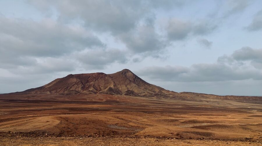
Islands like Sal, Boa Vista, and Maio are relatively flat and sandy. These islands receive less than 100 mm (3.9 inches) of annual rainfall. In Sal, the total of 145 mm confirms its classification as a desert. Here, the landscape is dominated by salt flats and dunes, such as the Deserto de Viana on Boa Vista.
2. The Semi-Arid and Sub-Humid Mid-lands
On islands with higher elevations, such as Santiago, Santo Antão, and São Nicolau, the terrain creates its own microclimates. As humid air is forced up the mountain slopes (orographic lift), moisture condenses into mist and clouds. This “occult precipitation” allows for the growth of dry monsoon forests and even lush vegetation in deep valleys (ribeiras), where banana plantations and sugarcane fields thrive.
3. The Humid Highlands
In the highest peaks, rainfall can exceed 1,000 mm (39 inches) per year. These areas support rare Macaronesian laurel forests and provide the vital catchment areas for the islands’ limited groundwater supplies.
The Paradox of the “Cape Verde Hurricanes”
One of the most fascinating aspects of Cape Verde’s meteorology is its role in global weather. The islands are the birthplace of “Cape Verde-type hurricanes.” These tropical cyclones form near the archipelago from atmospheric disturbances (African Easterly Waves) moving off the coast of Senegal.
While these storms rarely strike the islands directly—with notable exceptions like Hurricane Fred in 2015—they gain immense strength as they travel across the warm Atlantic toward the Caribbean and North America. Ironically, while these storms bring devastating rain and wind to the Western Hemisphere, they often leave the Cape Verde islands themselves parched and waiting for rain.
The Impact of History and Climate Change
The arid climate has shaped Cape Verdean history. During the 18th and 19th centuries, persistent droughts led to catastrophic famines, which in turn sparked waves of emigration. Today, the Cape Verdean diaspora in the United States and Europe significantly outnumbers the roughly 530,000 residents on the islands.
In the modern era, Cape Verde is on the frontlines of the climate crisis. In 2011, the President of Nauru ranked Cape Verde as the eighth most endangered nation due to flooding and rising sea levels associated with climate change. UN Secretary-General António Guterres has highlighted the archipelago as a symbol of the “existential crisis” facing small island developing states.
Resilience and the Green Transition
Despite the challenges of the Sahelian belt, Cape Verde has emerged as a leader in sustainability. Lacking natural resources like oil or minerals, the government has turned to the elements that define its climate: wind and sun. As of 2023, 20% of the nation’s energy is derived from renewable sources, with a goal to reach 50% by 2030.
Furthermore, Cape Verde recently made history with one of Africa’s first “debt-for-nature” swaps. In an agreement with Portugal, €140 million of debt was forgiven in exchange for investments in environmental and climate projects. This innovative financing model aims to protect the islands’ unique biodiversity—including endemic species like the Alexander’s Swift and the Raso Lark—while fortifying the nation against the encroaching desertification of the Sahel.
Practical Information for Travelers
- Best Time to Visit: For those seeking sun, November to June offers clear skies and pleasant temperatures (averaging 22°C to 25°C).
- The “Rainy” Season: August to October can be humid. While rain is infrequent, the landscape turns remarkably green during this window.
- Water Conservation: Visitors should be mindful that water is scarce; most tap water is produced via desalination plants, a vital technology for this semi-arid nation.
Cape Verde remains a “success story” of democracy and development in Africa, proving that even in the heart of the semi-arid Sahelian belt, innovation and resilience can make the “Green Cape” bloom in its own unique way.
Image: Pexels – Bibi Kiekens